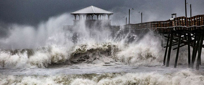
The Storm Approaches
September 15, 2018
Hurricane Florence, it’s the storm that has been on the mind of most of those who reside on the east coast for the past week. Today it starts its campaign to destroy great swaths of the coast and cause massive amounts of flooding. While we in Maryland may be spared for now we cannot say the same for our brothers and sisters in the Carolinas who are facing the forefront of this massive system. Starting as a tropical storm in the Atlantic and fluctuating up to a category 4 and down to a category 2 this storm has switched directions a couple of times and continuous to prove unpredictable.
Hurricane Florence first started about two weeks ago on August 30th off of the West coast of Africa as a tropical weather anomaly. A couple of days later Florence qualified as tropical storm and by September 10th the storm qualified as a category 4 Hurricane. Again going through some more weather fluctuations the storms wind field expanded as it was decreased to a category 1 storm yesterday morning. To be clear when a storm is categorized it is done so on the basis of its sustained winds and its categorization does not take into account necessarily the amount of rain fall expected or the storm surge it is expected to bring. Do not let the forms decreased category fool you the real threat of this storm comes from the rain and storm surge it is expected to bring with potentially affected areas stretching from Georgia to Maryland.
Quite obviously the areas that will be most at risk are the coastal regions of the Carolinas as well as some parts of Virginia. The storm made landfall today near Wrightsville Beach in North Carolina. North Carolina and the northern end of South Carolina is expected to get the worst of the storm where it is predicted to have storm surges of 11 feet as well as multiple feet worth of rain coming down upon them. Prior to this massive storm thousands of people were evacuated from the worst of the storm areas with the governors of Georgia, Virginia, Maryland, and the Carolinas declaring states of Emergency. The storm is expected to stay around the Carolina area for the next two or three days after which it may turn northeast or northwest it depends very much on how the storm reacts to surrounding weather patterns.
Where ever you are on the east coast you would do well to keep an eye on this storm as it has proven to fluctuate quite drastically over the course of its lifespan. To those in the mid southern eastern seaboard gather what supplies you can and be prepared for one of the worst storms in recent memory.
Sources:
https://en.wikipedia.org/wiki/Hurricane_Florence
https://www.usatoday.com/story/news/2018/09/14/hurricane-florence-what-we-know-and-what-expect/1299858002/
https://www.nhc.noaa.gov/refresh/graphics_at1+shtml/153133.shtml?rainqpf#contents


MsG • Sep 15, 2018 at 1:41 pm
… and the student becomes the master! Nice article Ethan! I commented to my ESSR class on Friday that I haven’t produced a meteorologist yet. Maybe I have!